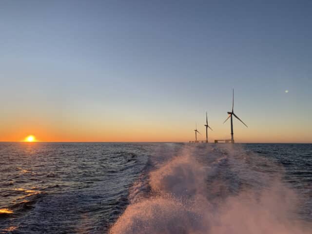
North Sea projects point way forward for monitoring of offshore bird patterns
Category
Environment
Date
1 February 2024
Location
Offshore
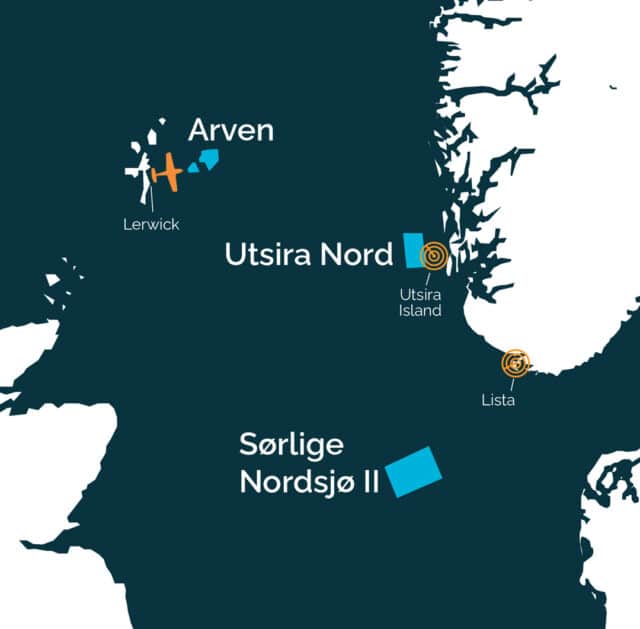
Mainstream offshore wind project sites in the North Sea
A new report for Mainstream and other offshore wind developers has proposed a long-term programme to monitor bird movements across the North and Norwegian Seas, integrating a wide range of technologies to map this “as-yet relatively uncharted territory”.
The plan outlined by the Norwegian Institute of Nature Research (NINA) addresses for the first time the “almost complete lack of knowledge” around migratory patterns in sea areas that are being opened up to offshore – and especially deep-water floating – wind developments.
Closing that knowledge gap, with NINA as project manager, has been prioritised by Norway’s wind industry research body, Northwind, of which Mainstream is a member. Species-specific data on migration numbers, timings and flight paths will be vital in developing the collision risk models and mitigation measures necessary to accelerate the consenting process.
The combined sensor and non-sensor-based approach recommended by the NINA report authors – employing weather and avian radars, biologging, acoustics, laser scanners, satellite imagery, camera technology and citizen science – could also identify any changes in migratory patterns over the longer term.
As the following case studies illustrate, Mainstream and its respective joint venture partners are already employing some of these technologies in the development of its three North Sea projects: Arven off the Shetland Islands, and Utsira Nord and Sørlige Nordsjø II in Norwegian waters.
Visualising migration patterns is on the radar in Norway
Radar data is being collated with camera imagery and human sightings to create a picture of bird activity in potential onshore and offshore wind farm locations across Norway, writes Karen Brinchmann.
The country’s wind industry research body, Northwind, launched the monitoring initiative when Mainstream and other developers identified the migration paths and behaviours of birds as an early knowledge gap.

Karen Brinchmann is an Environmental Impact Assessment Specialist with Mainstream’s Offshore Wind team
Information that is now being gathered and analysed by project managers at the Norwegian Institute of Nature Research (NINA) will feed into the development planning process, from early site selection decisions and risk identification, to planning operational-phase monitoring and potential mitigations to reduce environmental impacts.
Visualizing Avian Migration, or VisAviS, as the project is known for short, uses a variety of methods in the collection of information. Data from weather radars, which have ranges of 25-50 km, is being filtered in novel ways to extract the altitudes, directions and times of day and year that birds, bats and even clouds of insects are flying.
This is then correlated with findings from high-resolution bird radars on the Lista peninsula and Utsira Island, which provide a four-kilometre vision out beyond the southern tip of Norway and the lower ‘West Fjordland’ coastline respectively. Bird cameras that can identify species at distances of up to 2,000 metres are also employed, and detailed observations are being submitted by bird watchers using a smartphone app, too.
The two-year survey began in spring 2023 and early data has been detecting activity by the size of bird and flock over the course of months, greatly improving understanding of migration variations.
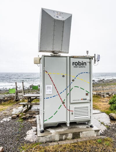
This bird radar station on Norway’s southern Lista peninsula is mapping migratory routes
In the Netherlands, where the use of weather radar data was first tested, the added context of metrological conditions is allowing migration behaviours to be predicted with new accuracy, and the information is already being used to minimise bird collisions through curtailment plans.
VisAviS findings are expected to support the development of Norway’s Sørlige Nordsjø II and Utsira Nord sea areas, where Mainstream is planning bids as part of separate consortia. It is envisaged the approach to bird monitoring could also be rolled out globally and, with planned online tools, enable better assessment of biodiversity risks for any Mainstream onshore or offshore site.
- Read the full NINA report, Long-term monitoring of bird migration across the North and Norwegian Seas, here.
Capturing a bird’s eye view of Shetland Island’s marine life
An aerial survey campaign that was recently launched to support the development of the Arven Offshore Wind Farm is compiling the first comprehensive record of wildlife activity off the Shetland Islands’ eastern coast.

HiDef aircraft fly just 500 metres above sea level to record bird activity
Detailed imagery of the proposed project area and its surrounds are now being captured at monthly intervals by a specialised, high-definition camera rig mounted on an aircraft flying at heights of just 500 metres above the sea surface.
Over the two-year study period, data from the photographs and video footage will help to characterise the foraging areas and migration routes of the most common marine life in these waters.
Relatively little is known about the activities of bird species such as the Black and Common Guillemots (known by Shetlanders as Tystie and Longwi or Loom, respectively), Fulmar (Maalie), or marine mammals like the Harbour Porpoise (Neesick) in and around the Arven project area, which expanded its footprint by almost a third in August 2023 with the addition of a second site.
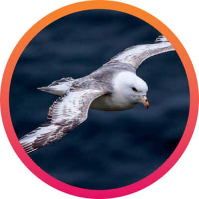
Survey data is building a picture of Shetland species like the fulmar
The survey data, gathered by environmental consultants HiDef Aerial Surveying, will form part of Arven’s Environmental Impact Assessment (EIA), informing consent application decisions and, potentially, measures designed to mitigate any impact risks on the local environment and other marine users.
With thousands of images having already been analysed by his team, Dr Glen Tyler, Principal Consultant at HiDef Aerial Surveying Limited, said: “Located far up north, Arven is unlike any site we’ve surveyed before. Fortunately, I’m based in Shetland, making this project a unique experience for me. It’s great to collaborate with a team like Arven, that values minimising environmental impact, mirroring the driving force behind my work.”
Arven, a 50:50 joint venture between Mainstream and Ocean Winds, is a floating offshore wind project comprising a 1.8 GW site east of the Shetlands, and a 500 MW site a little more inshore.
Once operational, it is expected to have the capacity to generate enough electricity to power the equivalent of more than two million homes, playing a key role in decarbonising the UK power system and meeting Scotland’s energy transition and net zero ambitions.
- A longer version of this article appears on the Arven Offshore Wind website here.
Related News
View all News
Media Enquiries

Emmet Curley
Head of Communications and Positioning


